


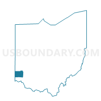
MIDDLETOWN CITY MIDD3WD1 Voting District, Butler County, Ohio
About
Outline

Summary
| Unique Area Identifier | 643201 |
| Name | MIDDLETOWN CITY MIDD3WD1 Voting District |
| County | Butler County |
| State | Ohio |
| Area (square miles) | 0.82 |
| Land Area (square miles) | 0.80 |
| Water Area (square miles) | 0.01 |
| % of Land Area | 98.33 |
| % of Water Area | 1.67 |
| Latitude of the Internal Point | 39.53861790 |
| Longtitude of the Internal Point | -84.33862280 |
Maps


Graphs
Select a template below for downloading or customizing gragh for MIDDLETOWN CITY MIDD3WD1 Voting District, Butler County, Ohio


Neighbors
Neighoring Voting District (by Name) Neighboring Voting District on the Map
- 0008 FRA-C-SW Voting District, Warren County, OH
- 0050 FRA-T-NWB Voting District, Warren County, OH
- 0054 FRA-T-SWA Voting District, Warren County, OH
- 0055 FRA-T-SWB Voting District, Warren County, OH
- 0113 FRA-T-NWC Voting District, Warren County, OH
- MIDDLETOWN CITY MIDD2WD1 Voting District, Butler County, OH
- MIDDLETOWN CITY MIDD4WD1 Voting District, Butler County, OH
- MIDDLETOWN CITY MIDD5WD1 Voting District, Butler County, OH
- MIDDLETOWN CITY MIDD6WD1 Voting District, Butler County, OH
Top 10 Neighboring County Subdivision (by Population) Neighboring County Subdivision on the Map
Top 10 Neighboring Place (by Population) Neighboring Place on the Map
Top 10 Neighboring Unified School District (by Population) Neighboring Unified School District on the Map
- Middletown City School District, OH (49,409)
- Franklin City School District, OH (19,670)
- Carlisle Local School District, OH (9,646)
Top 10 Neighboring State Legislative District Lower Chamber (by Population) Neighboring State Legislative District Lower Chamber on the Map
Top 10 Neighboring State Legislative District Upper Chamber (by Population) Neighboring State Legislative District Upper Chamber on the Map
Top 10 Neighboring 111th Congressional District (by Population) Neighboring 111th Congressional District on the Map
Top 10 Neighboring Census Tract (by Population) Neighboring Census Tract on the Map
- Census Tract 301.01, Warren County, OH (4,390)
- Census Tract 325.02, Warren County, OH (4,180)
- Census Tract 306, Warren County, OH (3,615)
- Census Tract 122, Butler County, OH (3,226)
- Census Tract 124, Butler County, OH (2,322)
- Census Tract 123, Butler County, OH (2,028)